Earn money Online
Check with seller
Check with seller
Other Services
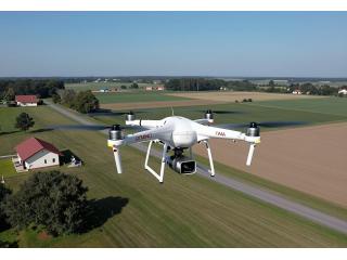
Unlock the potential of your land and projects with our state-of-the-art drone mapping services With advanced aerial technology, we provide high-resolution maps and 3D models tailored for construction, real estate, and environmental studies. Our experienced team ensures accurate data collection and analysis to help you make informed decisions. Whether you need topographic surveys or detailed land assessments, we’re here to assist you. Transform your projects with precision through professional drone mapping.
Published date:
May 1, 2026
Region:
Delhi
City:
New Delhi
Views
17


Useful information
User
Contact publisher
You must log in or register a new account in order to contact the publisher


Earn money Online
Check with seller


Healing Foundations ...
Check with seller
AreYou Tired Of Livi...
Check with seller


Marietta Junk Car Bu...
Free
